Spuren urgeschichtlicher Beackerung in West-, Mittel-, Ost- und Nordeuropa Traces of prehistoric farming in Western, Central, Eastern and Northern Europe: Langen-NW, Rhein-Main-Ebene, Hessen Rhine-Main Plain, Hesse Weiter more...
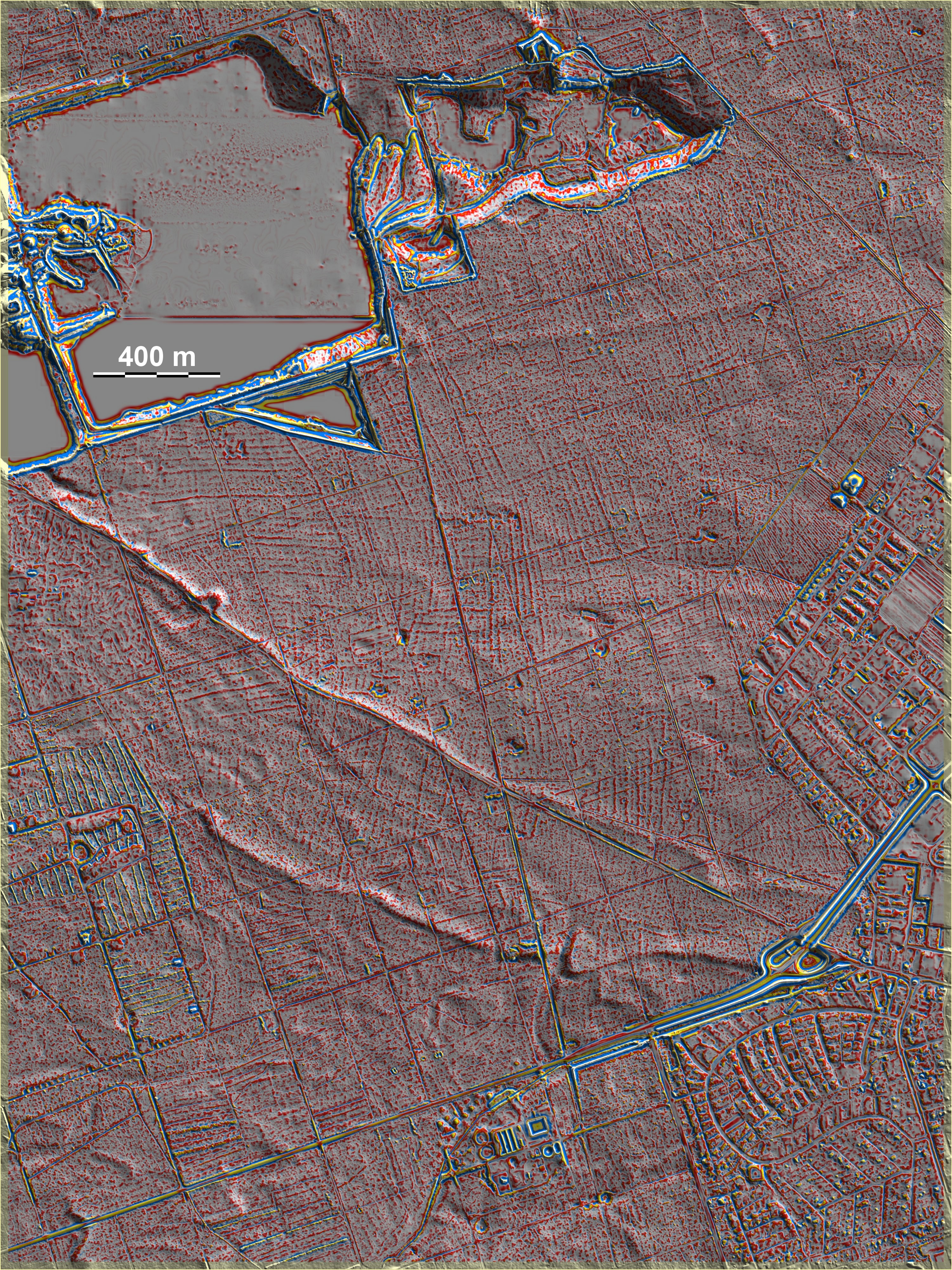
Nordwestlich von Langen finden sich im Wald zahlreiche Parzellierungsspuren vom Typ Sachsenhausen in teilweise recht kräftiger Ausprägung. In Grafikmitte deutet sich sogar eine Kammerung vom Typ Przemęt an. Von Bedeutung ist hier, dass es eine Reihe von natürlichen abflusslosen Senken gibt, die auch in unmittelbarer Nähe der Parzellierungsspuren liegen. Hier böte sich eine im Gebiet ziemlich einmalige Chance, die Bewirtschaftungsphase durch die palynologische Untersuchung der Vermoorungssedimente zu charakterisieren und zu datieren. Eine zweite Grabhügelgruppe liegt im Süden dicht nördlich der Kläranlage, außerdem liegt ein einzelner Grabhügel im Nordosten. Zugleich zeigt die Grafik eindrucksvoll die Gefahren der unbemerkten Zerstörung der Ackersysteme: Das Kiesabbaugebiet im Norden ist inzwischen erheblich erweitert, nordwestlich der kleinen Grabhügelgruppe ist ein Gutteil der gut erhaltenen Spuren inzwischen abgebaggert. Und: wo die Forstwirtschaft so intensiv eingreift wie am Westrand der Grafik, gehen Spuren unwiederbringlich verloren! Fortsetzung nach Süden: Egelsbach-West, nach Norden: Sprendlingen-Buchschlag-NW. Northwest of Langen, numerous Sachsenhausen-type parcellation traces can be found in the forest, some of which are quite pronounced. In the centre of the graphic, there is even a hint of Przemęt-type chambering. It is significant here that there are a number of natural drainless depressions that are also located in the immediate vicinity of the plot traces. This would offer a rather unique opportunity in the area to characterise and date the cultivation phase through the palynological study of the boggy sediments. A second group of barrows lies to the south, close to the north of the sewage treatment station, and there is also a single barrow to the north-east. At the same time, the graphic impressively shows the dangers of the unnoticed destruction of the arable systems: The gravel extraction area in the north has been considerably expanded in the meantime, and northwest of the small group of tumuli a good part of the well-preserved traces has been dredged away in the meantime. And: where forestry intervenes as intensively as on the western edge of the graphic, traces are also irretrievably lost! Continuation to the south: Egelsbach-West, tothe north: Sprendlingen-Buchschlag-NW. Weiter more...