Spuren urgeschichtlicher Beackerung in West-, Mittel-, Ost- und Nordeuropa Traces of prehistoric farming in Western, Central, Eastern and Northern Europe: Schaafheim-NW, Rhein-Main-Ebene, Hessen Rhine-Main Plain, Hesse Weiter more...
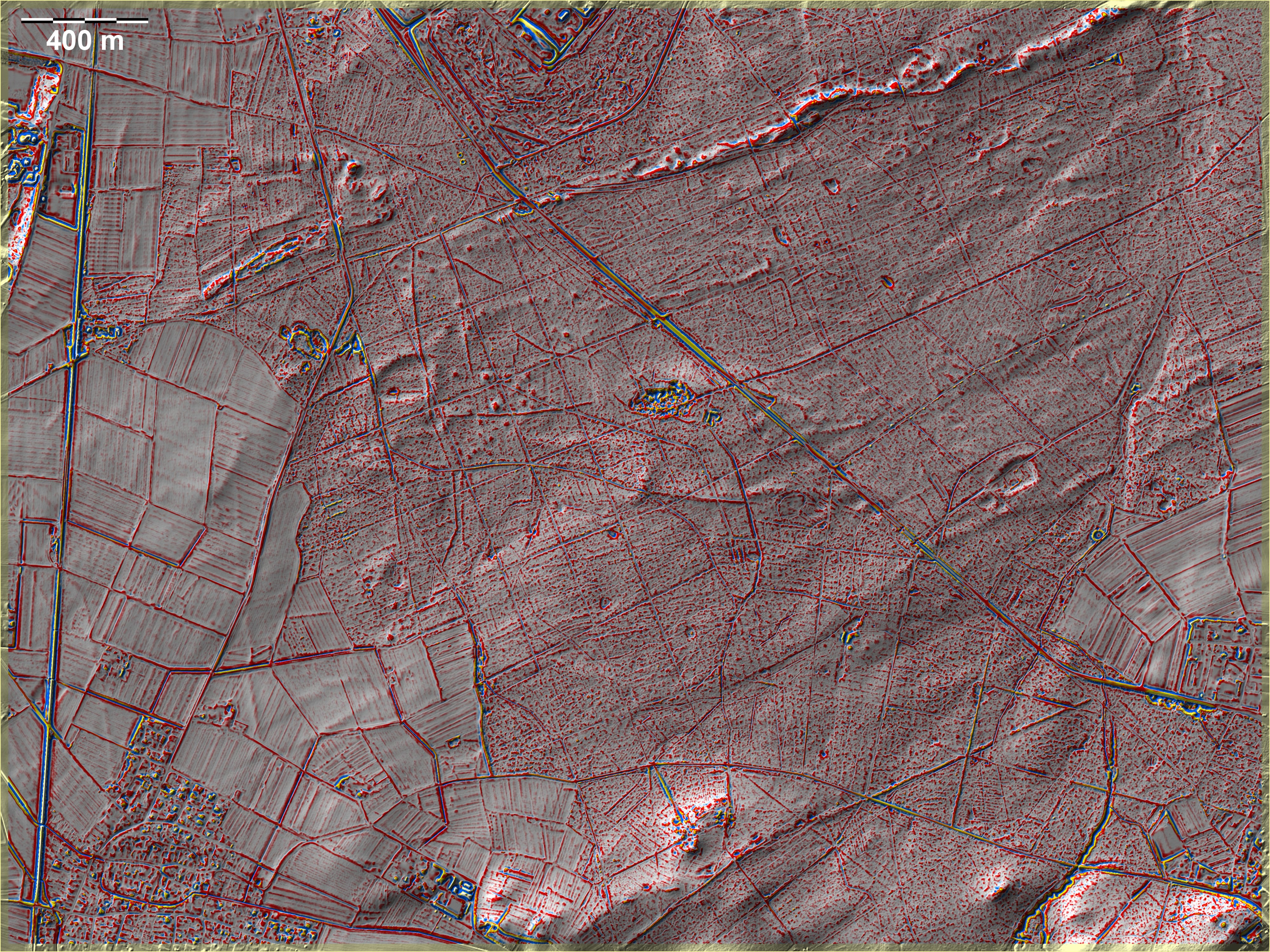
Nordwestlich von Schaafheim bei Babenhausen finden sich um eine Grabhügelgruppe nordwestlich der Bildmitte mehrere Dämme, die wohl nichts mit ackerbaulicher Parzellierung zu tun haben. Möglicherweise handelt es sich um Dämme, wie sie in Hügelgrabnekropolen z. B. im Taunus, aber vor allem im Hunsrück und in der Südeifel auftauchen und irgendwie zum Bestattungsritus gehören. Dort sind sie allerdings ganz überwiegend geradlinig. Ganz schwache und zweifelhafte Parzellierungsspuren findet man hier vor allem im Umfeld einer kleinen Grabhügelgruppe südöstlich der Bildmitte. In der Südostecke der Grafik weitere Grabhügel. Außerdem quert der Hohe Weg, eine Römerstraße, im Südosten den Wald von SW nach NE, leider ohne Parzellierungsspuren zur berühren. Northwest of Schaafheim near Babenhausen, around a group of tumuli northwest of the centre of the image, there are several dams which probably have nothing to do with agricultural parcelling. It is possible that they are causeways of the kind that appear in burial mounds, for example in the Taunus, but above all in the Hunsrück and in the southern Eifel, and are somehow part of the burial rite. There, however, they are quite predominantly rectilinear. Very faint and doubtful traces of parcelling are found here, especially around a small group of burial mounds southeast of the centre of the picture. In the south-east corner of the picture there are further tumuli. In addition, the Hohe Weg, a Roman road, crosses the forest from SW to NE in the southeast, unfortunately without touching any traces of parcelling. Weiter more...